West Nipissing Land Use and Development Strategy

Municipality of West Nipissing

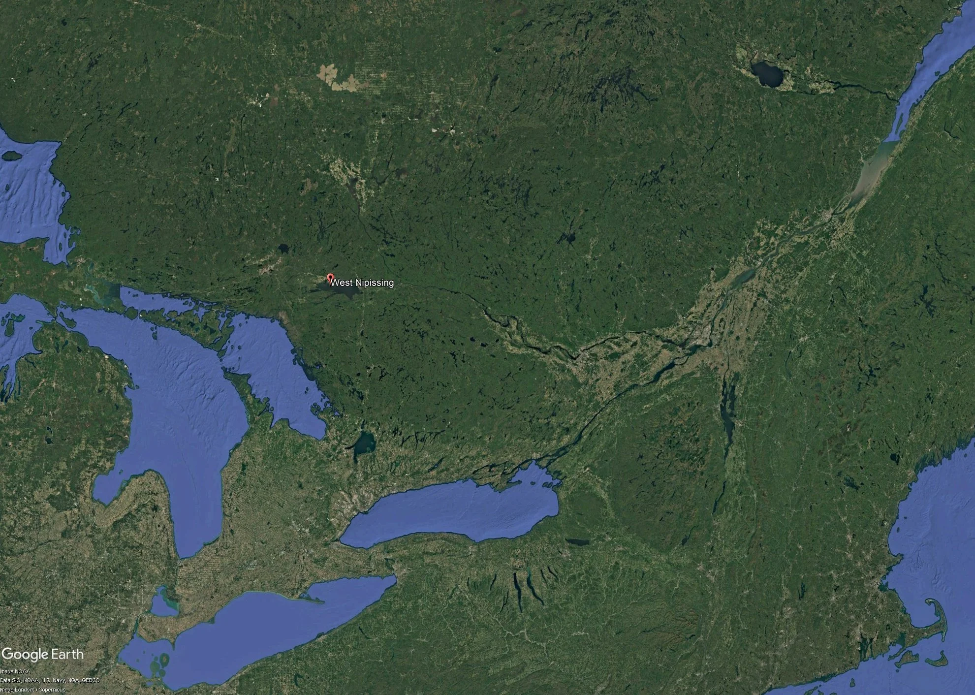
West Nipissing, Ontario

2022-2023

Colliers Project Leaders
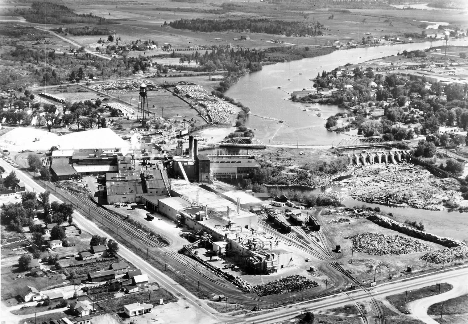
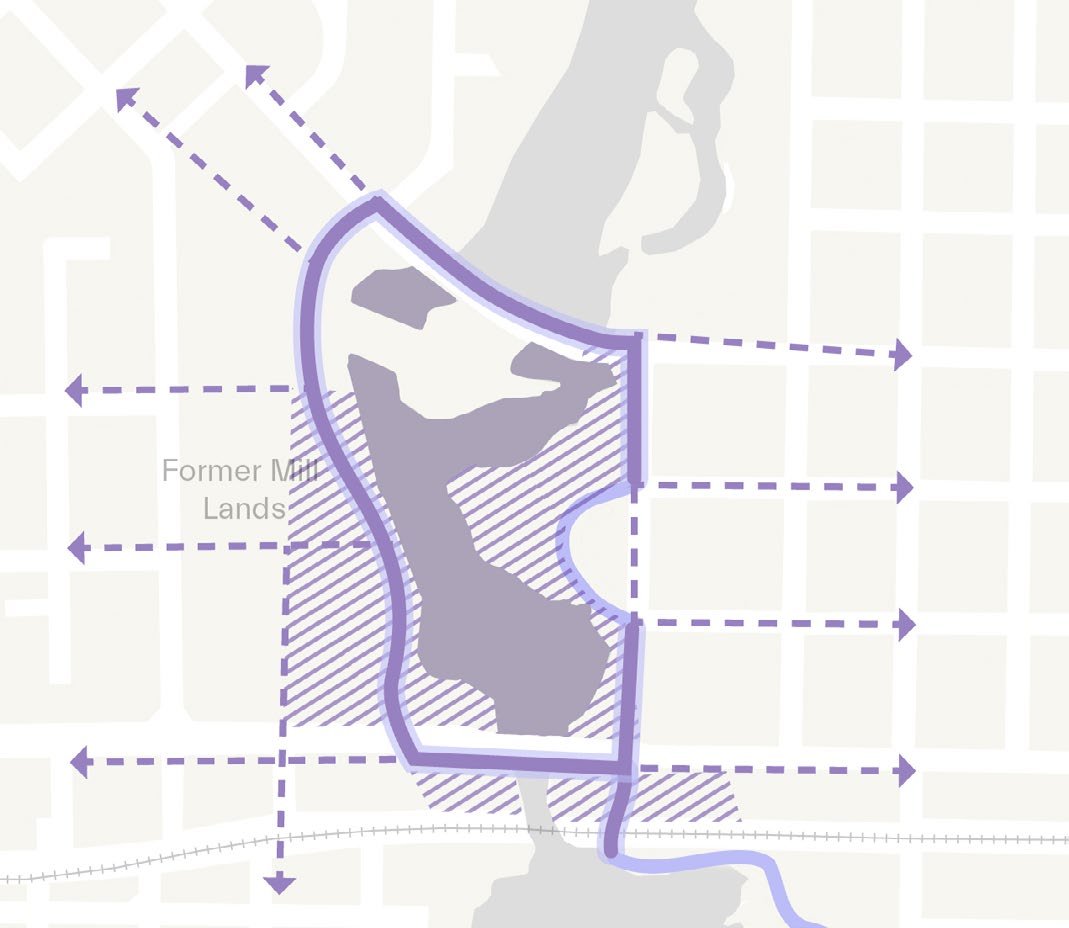
The West Nipissing Land Use and Development Strategy transforms a long-vacant industrial site into a new vision for the Sturgeon Falls riverfront. Once home to the Weyerhaeuser Mill, the 27-acre property played an important role in the community’s history before the mill’s closure in 2002 left a lasting physical and economic void.
Following the Municipality’s purchase of the site in 2020, Re:Public developed a community-informed framework for its next chapter, one that brings together new housing, economic activity, public riverfront space, tourism opportunities, and ecological restoration. Shaped through bilingual engagement and collaboration with Nipissing First Nation, the strategy reconnects the site with the town and lays out a practical path toward a vibrant, inclusive, and resilient waterfront district.
A Riverfront Loop
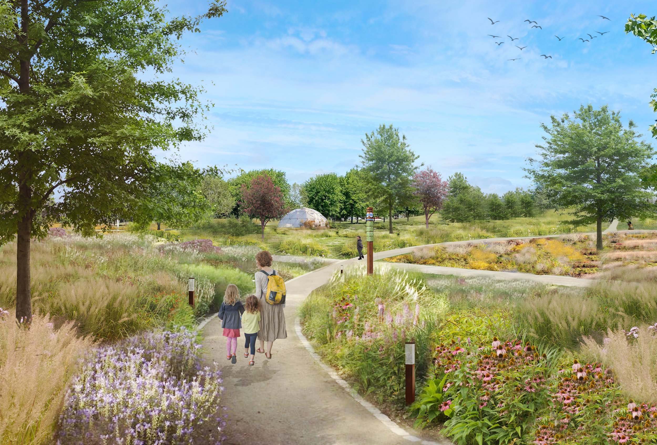
The development of the former mill site will re-establish a strong connection between the community and the Sturgeon River through the creation of a vibrant riverfront park and mixed-use urban space. Providing new opportunities for recreation and economic growth will breathe new life into these culturally and historically significant lands.

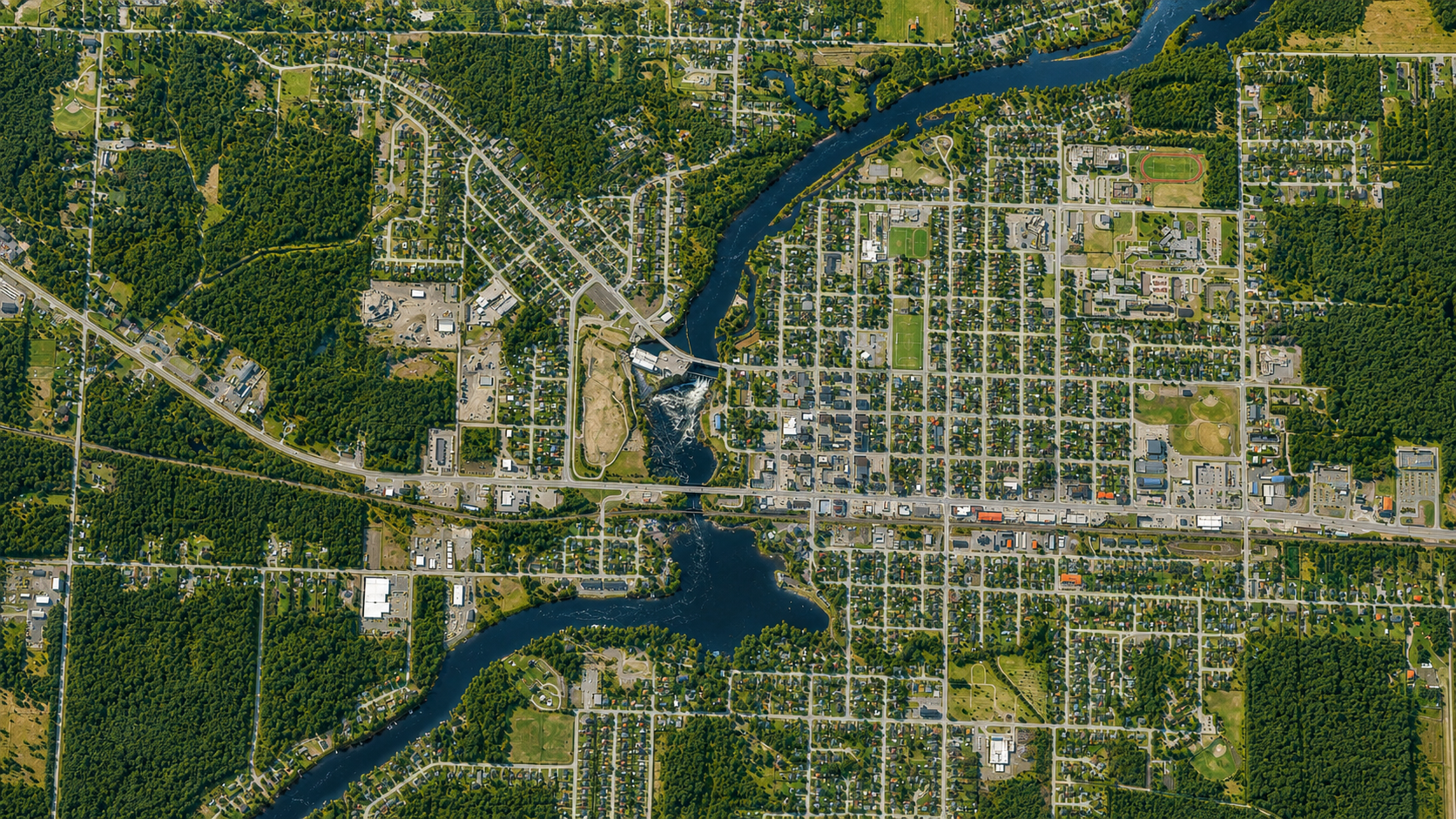
The Site Today: A Disconnected Riverfront
The Sturgeon Falls waterfront is a valuable natural asset, featuring picturesque views and a rich cultural history. Tourism, recreation, and other economic opportunities has remained largely untapped.

The Potential for a Riverfront Loop
This loop will feature a multi-use trail network, connecting the east and west sides of the river and providing visitors with an immersive experience of Sturgeon Falls’ natural beauty.
A Community Park xx
The Municipality will lay the groundwork for a vibrant and thriving area with the creation of a community park, where the Riverfront Loop has the potential to become a signature destination and contributing to the social vitality of the community.

Developing a District .
With increased interest and activity on the site, the lands abutting the park will become “The Falls District”, an area prioritizing neighbourhood development focused on liveabillity, outdoor lifestyle, and sustainability.
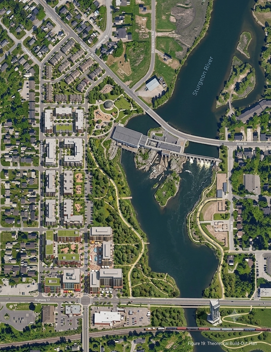
Theoretical Build-Out &
Land Use Plan
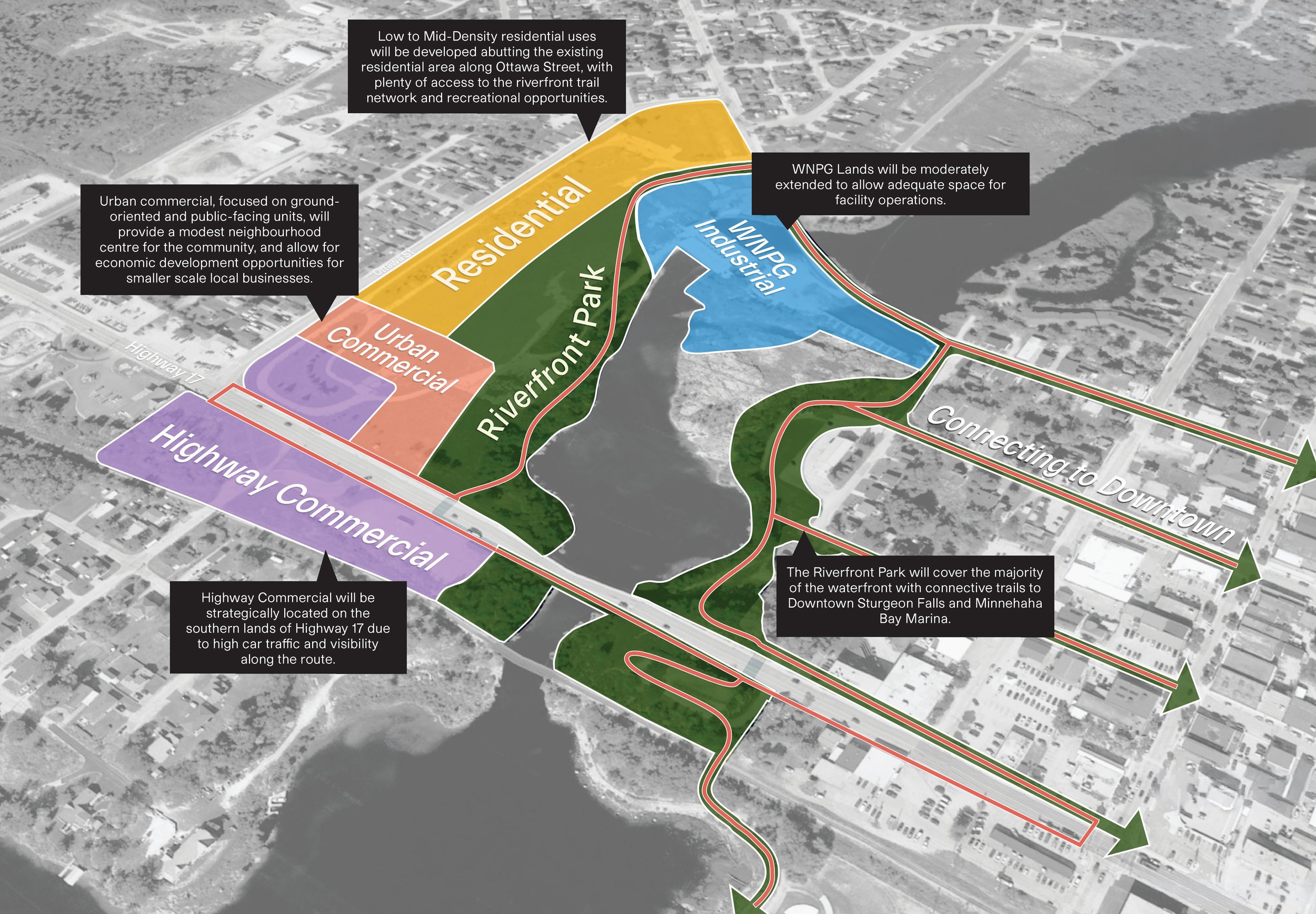
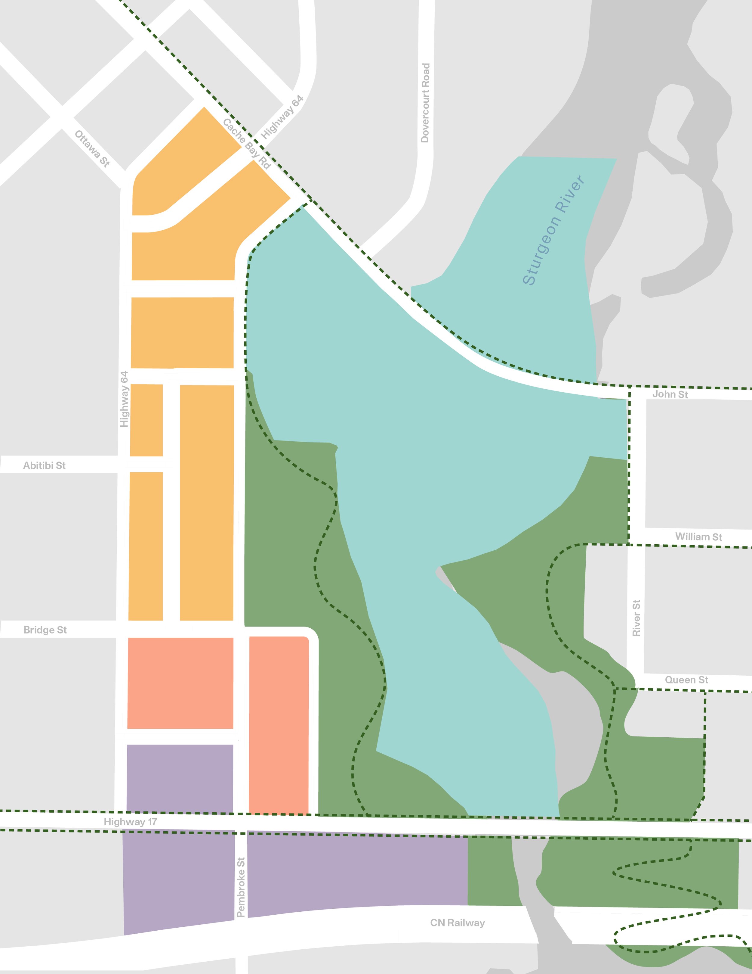
The site has been divided into five distinct areas, each serving a unique purpose:
A Residential Zone
Providing a comfortable and livable environment for residents while maintaining a visual and physical separation from other land uses.
A Highway Commercial Area
Accommodating commercial activities such as restaurants, retail stores, and service stations.
An Urban Commercial Area
Offering mixed-use development opportunities for a variety of commercial and residential uses in close proximity.
A Parkland Zone
Providing a natural and peaceful oasis for visitors and residents with various recreational opportunities and scenic views.
An Industrial Zone
Offering ample space for operations.

Implementation Strategy
The redevelopment of the former mill site presents a once-in-a-generation opportunity for the Municipality and the community of Sturgeon Falls. As such, an implementation strategy is critical to turn the development concept into a reality. The Municipality has determined that the preferred process for redeveloping the site will be largely undertaken by one or more private development companies. This implementation strategy outlines three primary phases leading to the development of the site, namely:
Community Engagement
Keeping the local community and interest holders informed of this important development
Development Preparation
The undertaking of site due diligence, identifying funding opportunities, and undertaking initial site preparation
Transfer & Build Out
Involving the selection of a development partner and the physical redevelopment of the site.
Read the full report here: West Nipissing Land Use and Development Strategy
Project Contact

Jesse McPhail
Partner | Urban Planner
mcphail@republicurbanism.com
Featured Projects
-
![]()
Cornwall Community Housing Development Plan
-
![]()
Port Hope Land Inventory
-
![]()
West Nipissing Land Use Strategy
-
![]()
Toronto Zoo Master Plan
-
![]()
Strathroy Downtown Master Plan
-
![]()
Sarnia Waterfront Master Plan