
Recent News
Map of the Month
Montreal: Four Seasons Cycling Analysis
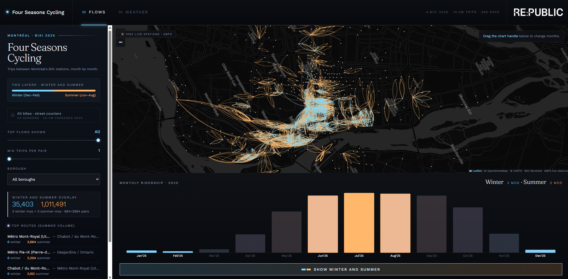
May is Bike Month in Montréal, and as the month wraps up, we thought it was a good opportunity to revisit some cycling data.
In 2023, we created an origin-destination map to better understand how people move through the city and identify the most travelled cycling routes.
Since then, Montréal's cycling network has continued to evolve. BIXI introduced its winter bike program, and the number of bike counters across the city has expanded, providing an even better picture of cycling activity year-round
The results highlight something many Montréalers already know: cycling is increasingly becoming a four-season mode of transportation. While weather certainly influences ridership, cyclists continue to use the network through a wide range of conditions, demonstrating the growing importance of safe, connected, and reliable cycling infrastructure throughout the year.
Explore the data at: https://lnkd.in/edzYQqzb