Climate Adaptation Mapping in Pangnirtung, Nunavut
Our team recently travelled to Pangnirtung, Nunavut to support the Climate Adaptation Mapping Project, guided by the BNQ 9701-500 national standard.
We wanted to share a bit about what this standard is, why it matters in a northern context, and how this project brings together scientific data with Inuit Qaujimajatuqangit (IQ) and community knowledge. Together, these perspectives help ensure the final outcomes reflect real-world conditions on the ground
Why Pangnirtung?
Northern communities are experiencing rapid environmental change, including permafrost thaw, flooding, erosion, and shifting coastal conditions.
Planning for future development requires a clear understanding of how land conditions are changing over time.
A first in Nunavut: This project marks the first time the BNQ 9701-500 standard is being applied in Nunavut. It represents an important step toward adapting national climate planning tools to northern and Inuit community contexts.
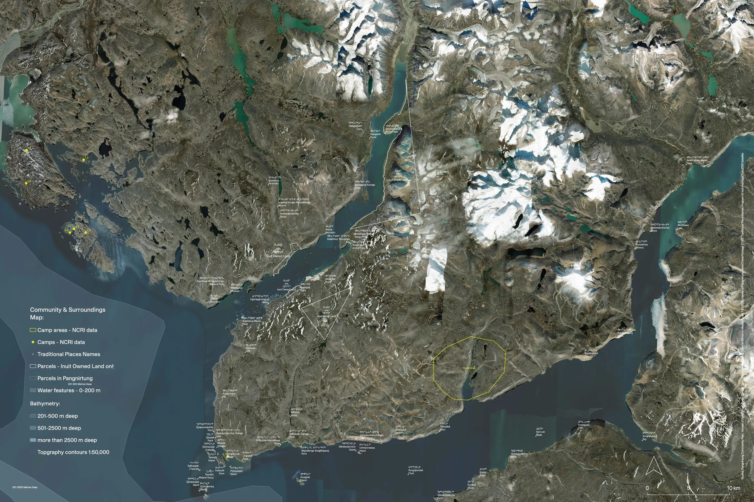
What Is the BNQ 9701-500 Standard
The BNQ 9701-500 approach centres Inuit Qaujimajatuqangit (IQ), Inuit Traditional Knowledge, alongside environmental information such as permafrost, water, terrain, and erosion to understand how land behaves today and how it may change in the future. This combined knowledge helps identify areas that are more or less susceptible to hazards, supporting climate adaptation planning.
What We’re Doing
As part of this climate adaptation mapping project, we are compiling and analyzing environmental data related to land stability, flooding, erosion, and climate hazards.
This includes identifying data gaps and translating complex information into clear, usable mapping for future planning.
This work is being carried out in collaboration with the Hamlet of Pangnirtung and project partnership with CIRNAC and the Government of Nunavut, supporting climate adaptation and planning in Nunavut.
Community Informed, Not Just Data Informed
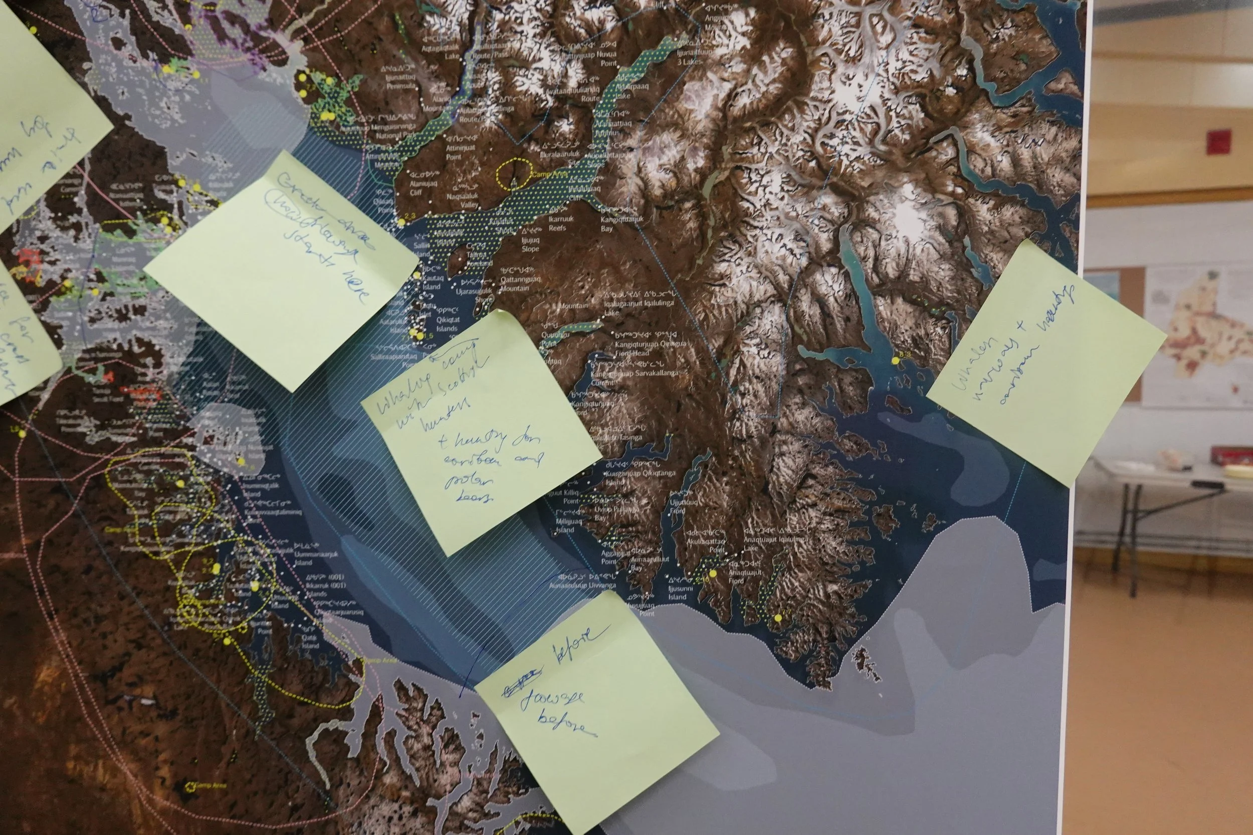
Environmental data provides a starting point, but community knowledge and lived experience on the land offer deeper insight into how places actually change over time.
Local knowledge is essential for validating data, understanding change over time, and identifying areas of concern and opportunity.
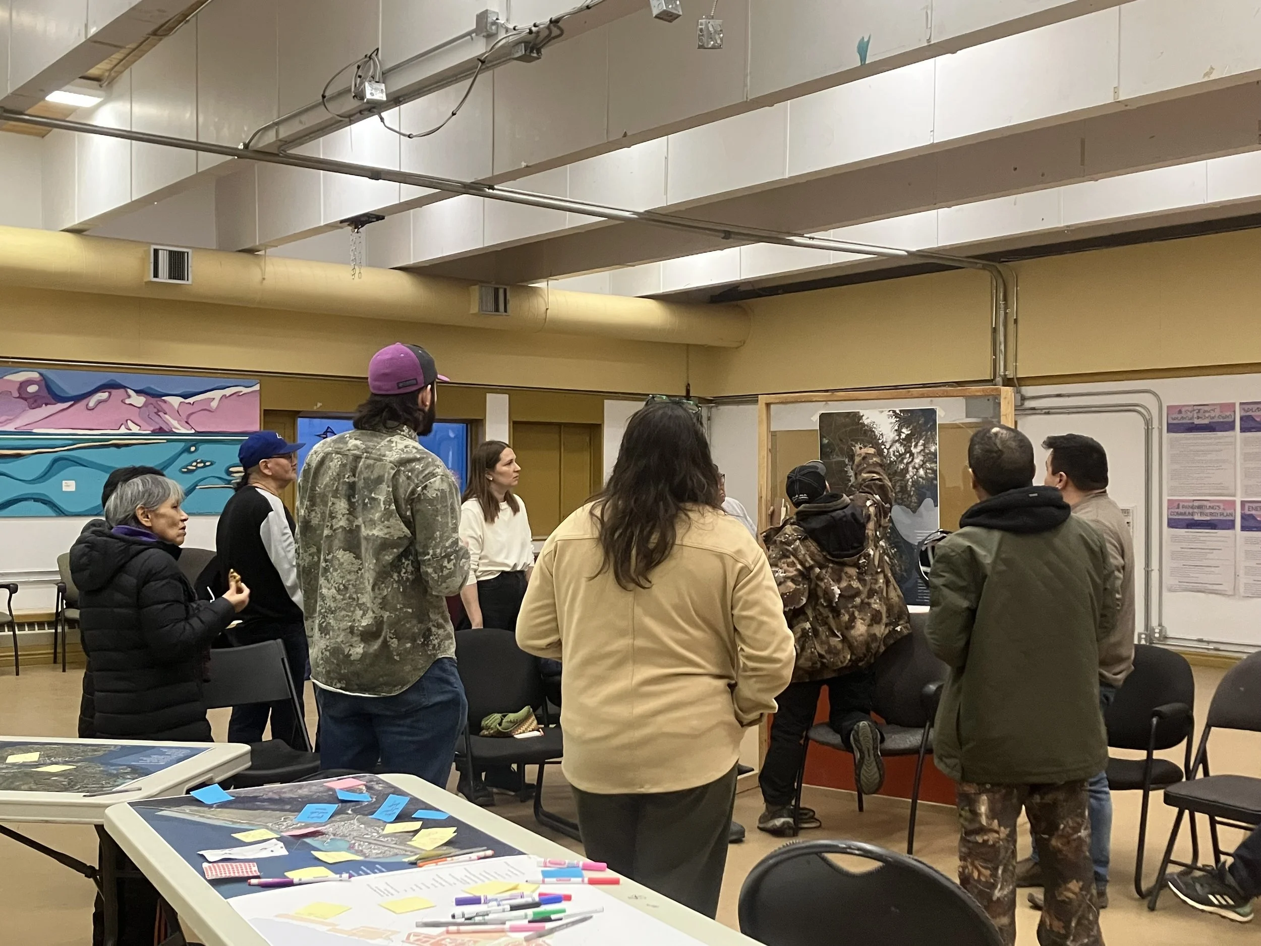
How We Engaged
During our visit, we met with community members and local representatives to listen, learn, and confirm what the maps do and do not show.
These conversations help ensure the work reflects real conditions and avoids repeating past studies or consultations.
What Comes Next
The results of this work will help inform future planning, land use decisions, and climate adaptation strategies in Pangnirtung.
The project also helps lay the groundwork for broader use of climate adaptation mapping across Nunavut.